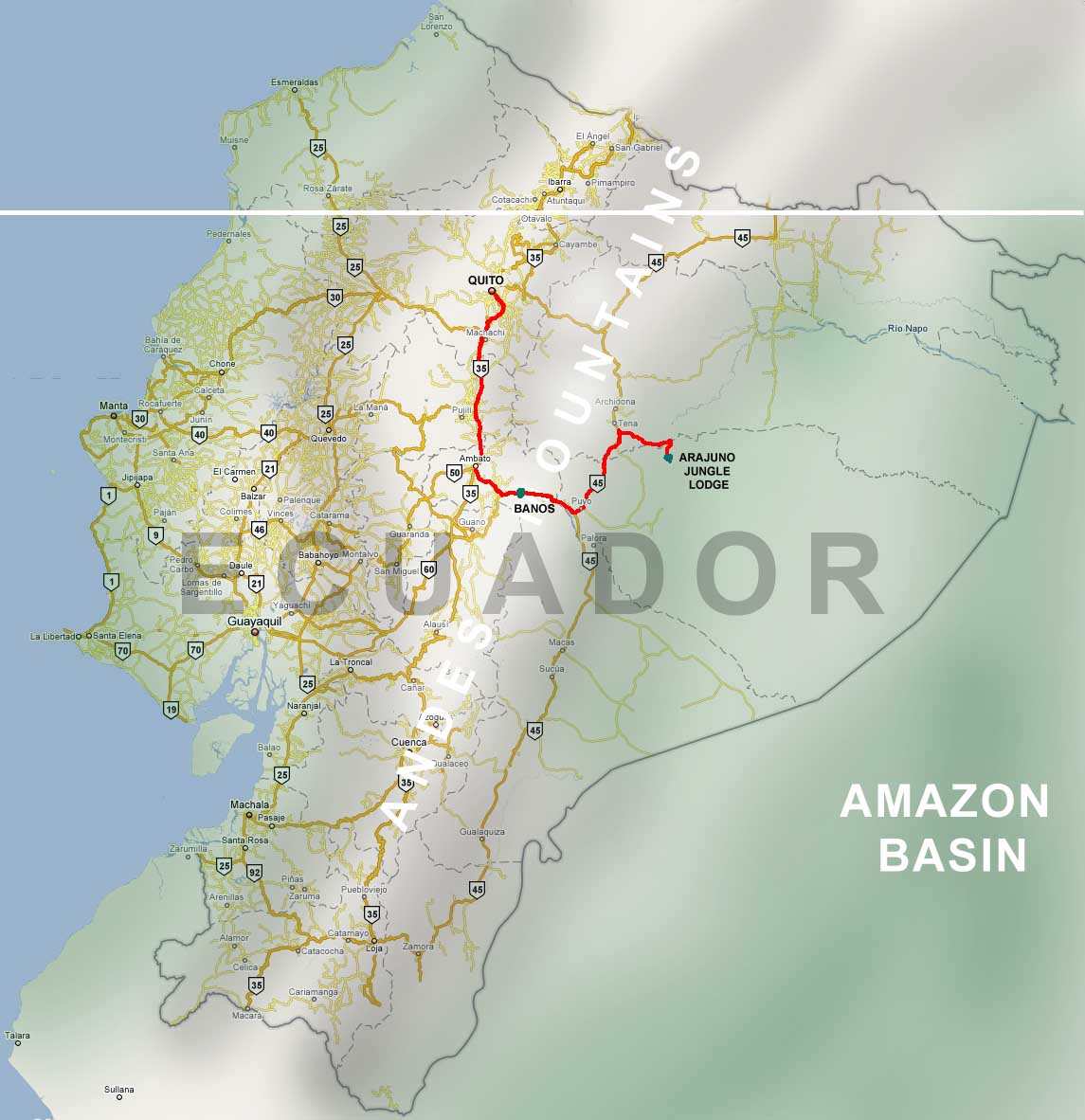
We will fly into Quito, the capitol city. Take the PanAmerican Highway south to Ambato, then south east to Banos, then turn north at Puyo on a gravel road, go about three hours to Pto. Napo, and turn east, following the river. At a bridge over the river we will stop, load up in canoes and go up river a couple of miles to the Lodge.
Map Coordinates (sorry no street address or P.O. Box) is 1 degree 06 minutes and' 05.07 seconds S. by 77 degrees 35 minutes 36.48 seconds W.
Eucador is geologically
and geographically one of the most diverse places on earth. Just
as a way to think about Ecuador, let's compare it to Colorado, they're about
the same size, and both divided by a mountain range running north to south.
Denver at the edge of the Rockies is about 5,200 feet above sea level (Tulsa
is 700'). Quito, lies in a valley between ranges of the Andes. It sit at
about 9,400 feet above sea level.
The highest peaks in the Rockies come in at about 14,000'. The Andes are about 18,000, with some peaks over 20,000. These are places only experienced mountain climbers go.
From Denver, the Rockies gently slope eastward, dropping about 1,600 feet in elevation over 150 miles to the eastern edge of the state.
From Ambato, our road will drop about 7,000 feet in 70 miles to the lodge. Hey, it's down hill all the way!
From the Andes range the terrain slopes all the way to the Amazon River. The lodge sits beside a tributary of the Amazon. In terms of diversity, it would be possible, to go from the steaming Amazon rainforest, over the snow-capped, glacier bearing Andes, down the aluvial plane to the sandy, sunny beaches of the Pacific ocean, in one day. Of course, you would need to pack a rain coat and shorts, a down coat and crampons and a bathing suit and suntan lotion.
RETURN
TO ECUADOR PHOTO SAFARI PAGE
RETURN TO DOUGLAS HENDERSON HOME